Cities benefit immensely from digital participation mechanisms. Gesa Ziemer, Director at the City Science Lab at Hafen City University in Hamburg, explains how!
In 2016 you quickly and unbureaucratically helped the city of Hamburg out of an emergency. What did the project 'Finding Places' achieve?
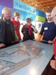
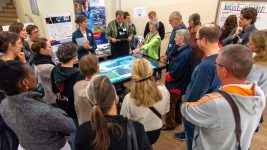
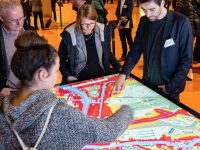
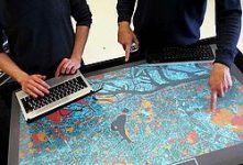
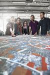
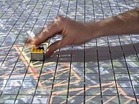
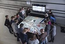
Finding Places was a GIS-based mapping of all public spaces in the city of Hamburg that was used for a citizen participation process to find accommodation for refugees. We built a so-called 'City Scope' for this, which we developed together with the MIT Media Lab. Citizens could look at the city of Hamburg in three different scales, the whole city, the district and in great detail the neighbourhood level. In an open participation process that lasted several months and was professionally moderated, citizens were able to contribute ideas about places where temporary accommodation for refugees should be built. They had to interactively navigate via a search stone to certain areas, which we had covered with a lot of information and which were discussed together. A central coordination staff for refugees then reviewed the proposals and commented on them on a website. This project helped to find places for shelters, but above all it was about collective opinion-forming. The political atmosphere was very tense at that time, some people did not want any refugees in the city. With Finding Places, we were able to show how complex a city functions and that it is not so easy to quickly accommodate so many people - there were around 40,000 - in such a short time. We tried to develop the mentality from 'not in my backyard' to collective responsibility, promoting dialogue instead of polarisation.
You are the director of the City Science Lab in Hamburg and call yourself a lab person. What do you achieve in your lab experiments and how do you go about it?
The City Science Lab at HafenCity University in Hamburg is special because we work very closely with different institutions, especially with the city authorities. We regularly get very specific requests and develop new projects in an agile way, together with test groups consisting of employees from the authorities. The large amounts of data we have available in Hamburg allow us to break down the data silos and work in an interdisciplinary way. I also liked Finding Places because the accommodation of refugees affected all authorities, such as finance, health, education, urban development. It could never have been solved by one authority alone. Our lab is based at a university, we are not a political party or a company that wants to sell something. We are a neutral place that is well suited for even controversial discussions about the future of the city. Through our work, we can generally stimulate a slightly different mindset, which I would call exploratory thinking with data. It also includes scenario thinking, which we all need to learn in order to tackle the complex challenges. Data help immensely to bring these discussions to the factual level and somewhat away from the emotional level. We provide the dramaturgies that enable many stakeholders to deal with this data.
As a cultural theorist, you come from a completely different background than geoinformaticians and geodesists. But you work together on sustainable cities. How important is that exactly - this interdisciplinary communication and how do you manage it?
That's very important to me and I think it's good right now that I'm not a geoinformatics specialist. I attach great importance to the fact that our lab is based on interdisciplinary team composition and diversity. We have researchers from geoinformatics, urban design, computer sciences, cultural and social sciences and art and design. It is this mixture that makes the projects interesting and successful. We are about 25 employees and deal with social issues such as the post-Corona city, very informatics-specific issues such as the creation of new technical interfaces in the Connected Urban Twin or new modelling possibilities in the field of BIM or CIM or the use of extended design realities, where art and design have a high level of expertise. All these facets are important in order to be able to communicate well with the outside world using geodata. It is also very important to me that we always have enough women in the team. We all know that this requires a bit more research on the subject, but I'm happy to do it. Of course, in everyday life it is sometimes challenging to bring these different cultures together. I enjoy it.
In the geocommunity the credo is always: No future without geodata. You say: no sustainable cities without communication, collaboration and participation. How does that fit together?
I absolutely share your credo! The question is what exactly we use this data for, what we do with it. I am currently writing a book together with Vanessa Weber entitled: 'Curating Data. New Forms of Collaboration in the Digital City.' Data is not only curated by machines, but also still by humans who select it and make it available on geolayers. This human-machine interplay is interesting and sometimes doesn't happen in such a reflective way. My focus on this book is then that we can use this data to develop new tools for collaboration. Collaboratively, therefore, we can map, design, decide or create today. Research shows that urban development today no longer works top down and that governments need to come up with good dialogue formats to engage with their citizens transparently and at eye level. This also sets up governance processes in the city. We would like to support these processes technically.
You are working on sustainable cities with the tools DIPAS (Digital Participation System) for citizens and COSI (Cockpit Social Infrastructure). What do the tools do and for whom are they intended?
One of our current projects is called COSI and is a cockpit for urban infrastructures that we are carrying out with the State Office for Geoinformation and Surveying. This tool is web-based and links social and urban data that we take from the transparency portal. Hamburg has a very good data situation. Our mayor would like to understand more about the city's social infrastructure and he wants the districts to shape it together and not just within their boundaries. With COSI, city staff can now not only access data directly via the master portal, but also link it and make needs or accessibility analyses or comparisons between districts. This tool is very well received by the city's employees. They submit their questions directly to us and we programme the corresponding functions. The DIPAS project is based directly on Finding Places and is a digital participation system that we developed in cooperation with the Department of Housing and Urban Development. DIPAS is a citizen participation tool that informs interested parties well about all new development projects, so that they can then enrich the projects with their ideas online (at home from their mobile phone or laptop) or offline (on site at the City Scopes). What is interesting about DIPAS is that we use machine learning here. To analyse the many comments, we have developed NLP-based functions that cluster and analyse them. This is an experiment that we are constantly researching. That is exactly why we need research in such projects.
May cities, municipalities, regions that are working on the sustainability of their jurisdictions contact you?
With pleasure. However, we have a lot to do at the moment. The Federal Ministry of the Interior has given money to many cities and regions in Germany in the large-scale funding programme 'Model Projects Smart Cities' so that they can build up and improve their digital infrastructure. That is right and was absolutely necessary. Hamburg will build a Connected Urban Twin with Leipzig and Munich, based on our existing Urban Data Platform. So we are heavily involved with Twin technologies and have the ambition to develop them for social data and citizen participation as well. Most Twins model traffic, logistics or infrastructure. We also want to bring in the social aspect. Many cities and regions are now opening City Labs because they have recognised that such places of innovation need to exist beyond the usually hierarchical structure of authorities. We are often seen as a model here because we have already been working successfully in Hamburg for five years. So we have our hands full right now.
Thank you very much for the interview. The interview was conducted by Monika Rech-Heider
INTERGEO 2021
Don't miss the presentation by Gesa Ziemer at the CONFERENCE!
Session: Tuesday, 21.09.2021 um 11:30 a.m.
Subject: SMART CITIES I – RESILIENT CITIES THROUGH DIGITALIZATION
Further information on the topic of Smart City at:
https://www.hcu-hamburg.de/res...
Gesa Ziemer is Professor of Cultural Theory at Hafen City University Hamburg. She is also director of the City Science Lab at HCU, a cooperation with the MIT Media Lab in Cambridge, focusing on the digitalisation of cities. Her further research focuses on urban public spheres and practices of participation, collective forms of work and artistic research. She is also the scientific director of the United Nations Technology and Innovation Laboratory UNITAC Hamburg, which focuses on the use of data in informal settlements.

